The town and the monastery were connected directly by a road that ran out through the lower gateway. The present line is almost the same as the original. A few years ago, steps were put in to make access easier for visitors and the old road can be seen alongside them.
As the population grew, the original space around the church became too small. Along the edges of the monastery road buildings were erected and eventually formed a district which, in documents from the 15th century, was baptised Sa Petja. We cannot estimate the total surface area, but its spread was most likely limited to the east by the steep slope and to the west by the rock of the mountainside.
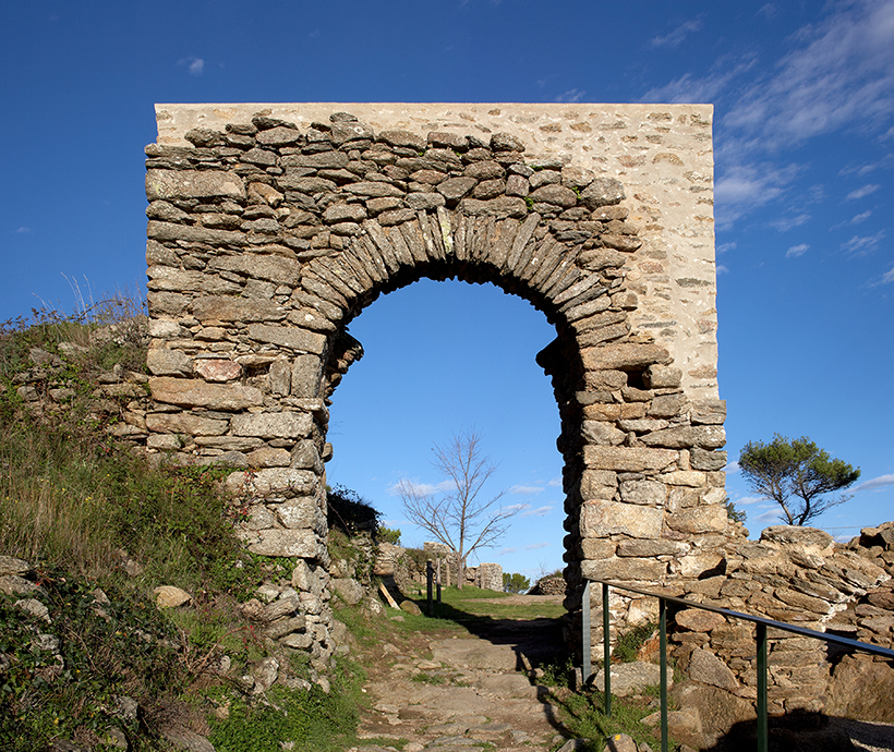
With the upper gateway this is all that remains of the original defensive system of the town. There is no evidence that this was a stone wall. The excavations have provided clues to a possible wooden palisade used to enclose it. With the growth of the town, that system was eliminated and the houses, with their massive walls and narrow doors, acted as a walled precinct.
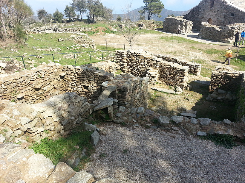
The houses built around the square are the oldest part of the town. The remains date back to the 12th century, although the structures we see today are from the mid 15th century.
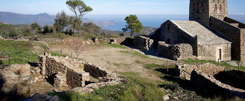
Located in front of the church, this square is the centre of the town, where public activity was concentrated and the main roads into the town met, as well as many of the streets and alleys. According to the records the stalls of the weekly market were set up here. They were patronised by many of the pilgrims visiting the monastery.
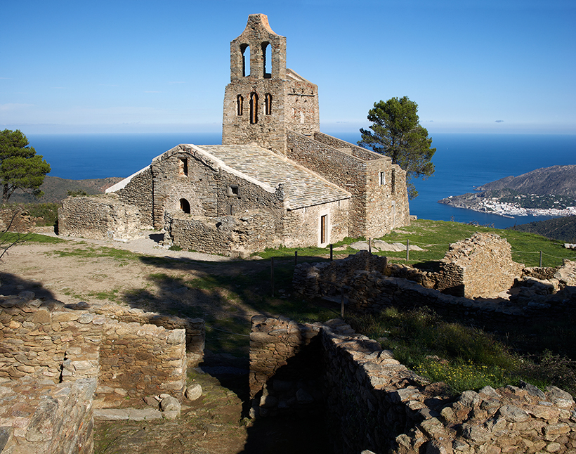
The church is a singular element in the town, since it was built before it and continued to be a place of worship after its inhabitants had abandoned it. Linked to the monastery, it came into being to provide a service for the people who lived scattered around the area. The first dedication was to the Holy Cross, but in the early 16th century it was dedicated to St Helena.
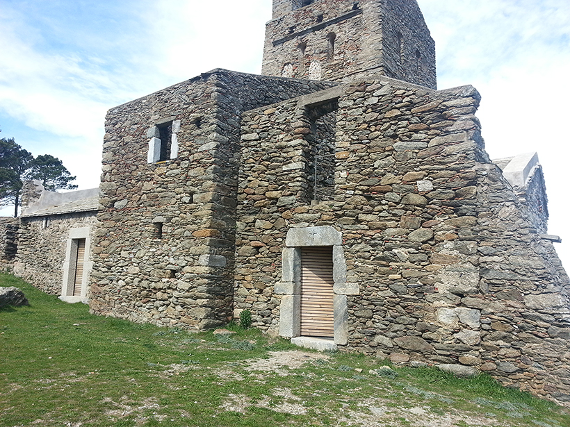
After the town was abandoned and the status of parish church lost, the church remained in the custody of a chaplain. According to a pastoral visit from the early 17th century, he had no house of his own and slept in the church. The fact that the bishop looked askance at that led to the building of this house, also called the new sacristy, in the first half of the 18th century.
In 1420 a new construction was attached to the chevet of the church to be used as a sacristy. It has a ground floor, a stone vaulted roof and another storey of which onlyy parts of the walls remain. The door still has an engraved cross on the lintel.
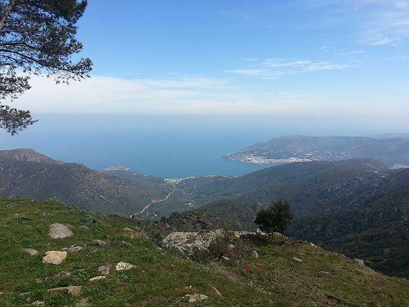
As opposed to how it might seem today, the zone in which the town is set was, in the Middle Ages, busy and inhabited. Sant Pere Monastery acted as an economic draw of the first order. The inhabitants of the area who provided services for the monastery and took care of the pilgrims profited. Moreover, they were engaged in wxploiting the available natural resources, basically the harvest of cereals, vines, olives and meadows.
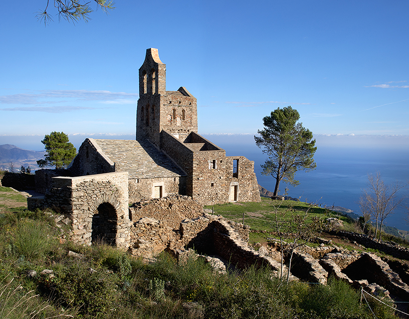
Around the church, from over the centuries we find the remains of various graveyards. The oldest is the one with the tombs excavated out of the rock, anthropomorphic in form with stone lids, which can be dated between the 10th and 11th centuries. Given that their existence precedes the building of the town, remains have been found over a broad area that overlaps with the surface area of the sanctuary, even under the houses, whose building damaged them seriously.
This is the oldest element of the church. Indeed it was there before it, since it was a watchtower for the surrounding territory, commanding a sweeping view of the coast. It has a square ground plan and the shape of a truncated pyramid, broader at the base. Originally it was roughcast with limestone mortar and there are signs that it was crowned with merlons.
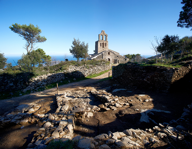
To the north of the church we can see the ruins of a district that stretched well beyond the original core. The first line of houses, with façades on the square, would not have been very different from the other dwellings around the church. However, we know nothing about the other buildings, what they were like or what uses they may have been put to, since there is no archaeologicla study.
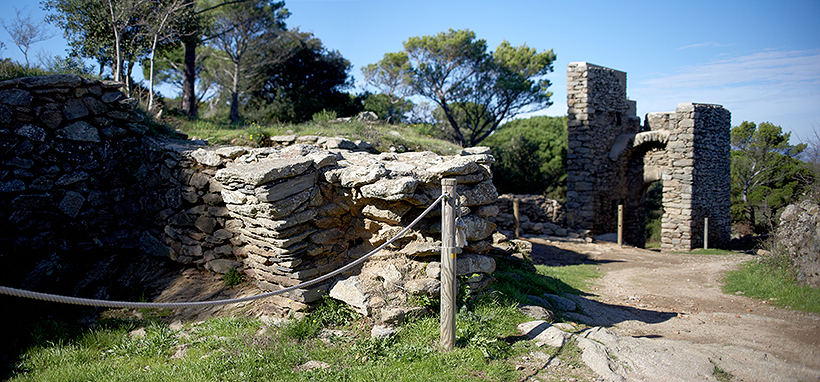
The tower of the upper gateway, with the lower gateway, bears witness to the old enclosure of the town. With a quadrangular ground plan it has solid walls one metre thick and has conserved some loopholes. It is of the open-backed type, that is, a tower open to the interior of the precinct. Thanks to the height which has been conserved, it has been established that it had two floors separated by a stone vault.
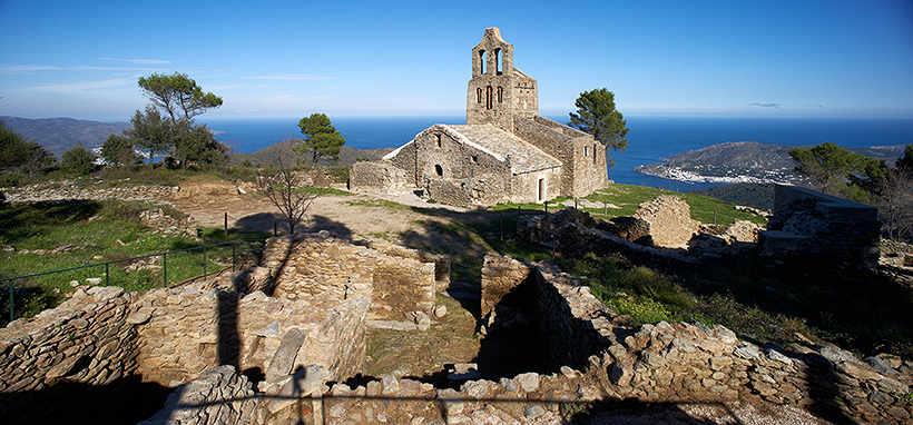
The first work to recover this archaeological complex was done in 1972, alongside the opening of the road to the monastery. The gateways were restored and the ground around the church lowered, incovering some of the town walls. At the same time the church was cleaned and reinforced.
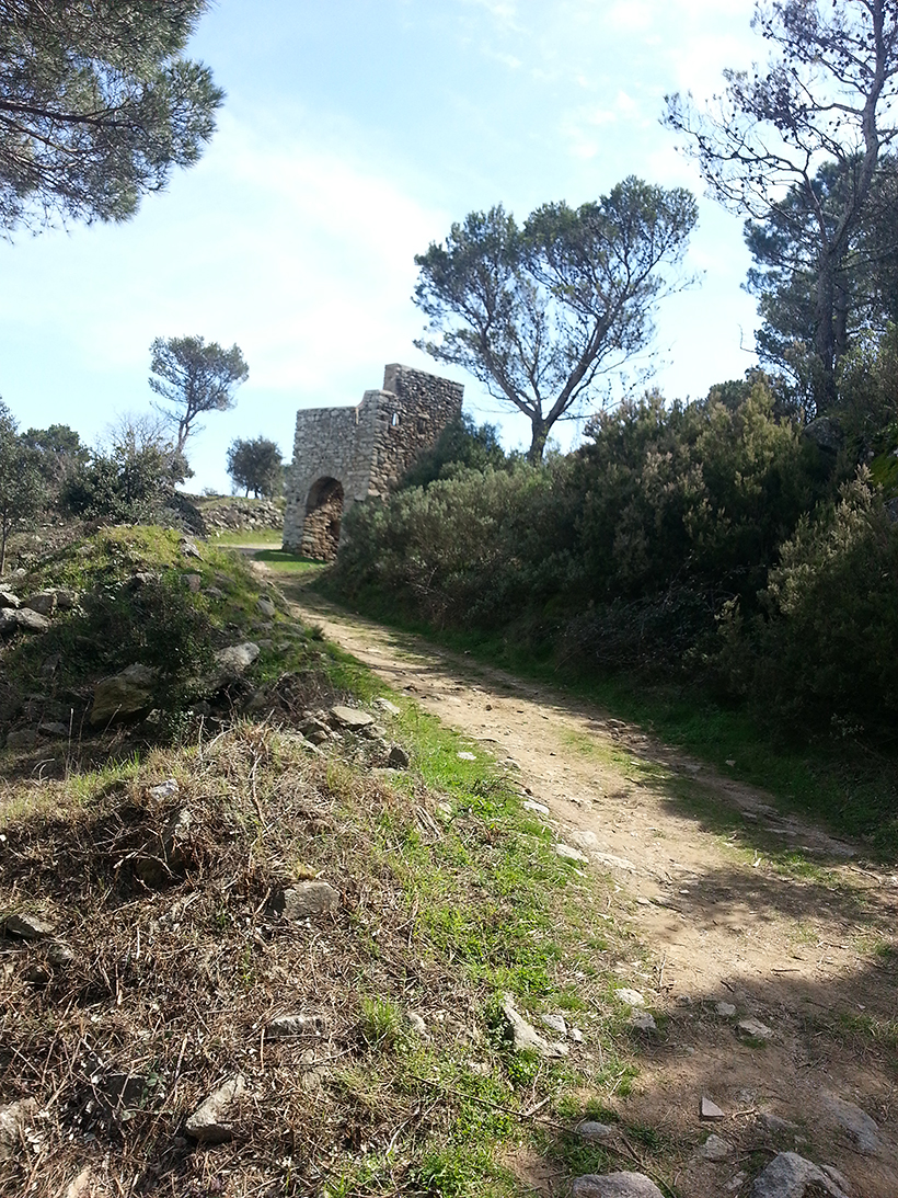
From the upper gateway runs a road, mostly overlapping with the original which connected Santa Creu with other towns on either side of the mountain. We know that there were junctions with the main highways that led to Vilajuïga, Pau and Palau, and from there to Castelló d'Empúries and Roses, and over to Llançà. Stretches of those roads are still conserved, mostly protected by high stone walls at the sides.
The town and the monastery were connected directly by a road that ran out through the lower gateway. The present line is almost the same as the original. A few years ago, steps were put in to make access easier for visitors and the old road can be seen alongside them.
Near the gateway the road becomes a town street. The neighbouring houses gave onto it through small doors, which are still well conserved. Between the houses allwyways led to the church square.
As the population grew, the original space around the church became too small. Along the edges of the monastery road buildings were erected and eventually formed a district which, in documents from the 15th century, was baptised Sa Petja. We cannot estimate the total surface area, but its spread was most likely limited to the east by the steep slope and to the west by the rock of the mountainside.
In the subsoil beneath the dwellings archaeologists have discovered grain silos which were there before the houses were built, as well as channels dug out of the rock to carry the rainwater down the mountain.
With the upper gateway this is all that remains of the original defensive system of the town. There is no evidence that this was a stone wall. The excavations have provided clues to a possible wooden palisade used to enclose it. With the growth of the town, that system was eliminated and the houses, with their massive walls and narrow doors, acted as a walled precinct.

The lower gateway is the entrance to the town from the monastery road. It is on the ground floor of an open-backed tower, one that is open to the interior of the precinct. It is difficult to make out the original shape, not only because of the state of conservation, but also because of the houses that were built up against it over time. It was probably not so different from the upper gateway, with a quadrangular ground plan and about 4.80 metres along the side.
The gateway is formed by a basket arch framed by stones laid as a border. There are signs of a portcullis and the base of a vault that covered the entrance. There are also remains of defensive loopholes, which were eliminated when the houses were built up against it.
The houses built around the square are the oldest part of the town. The remains date back to the 12th century, although the structures we see today are from the mid 15th century.

They are large houses, between 120 and 160 m2 in surface area, with a ground floor, upper floor and tiled roof. They have three or four rooms, some of which serve as a courtyard or even a garden, where vegetables such as beans and pears were grown.
Archaeologists have found remains of tableware, made in Valencia and Catalonia, utensils for the kitchen and larder and for other kinds of everyday use, iron and bronze tools, locks and keys, oil lamps, or clothing items such as buckles or needles. The presence of farming tools suggests that some of the inhabitants grew both vines and cereals, since grains of barley, wheat, millet and maize have been found.
In one of the houses a set of measures for selling wine retail have been found, which may indicate a tavern or shop. In another the presence of n unusual number of pots may mean that it was a hostelry, perhaps for the pilgrims who visited the monastery.
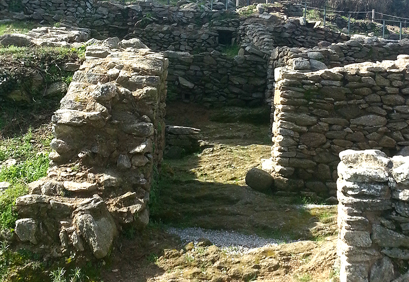
The main entrance to these houses opened onto the square. The door led to an antechamber where economic activities may have taken place. Beyond that were the more private spaces.
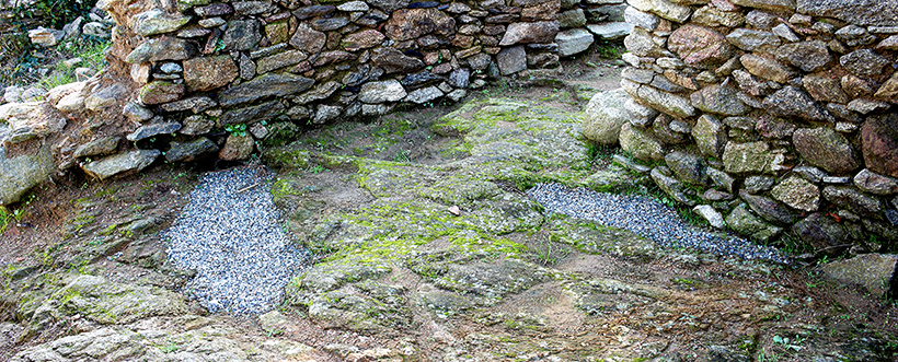
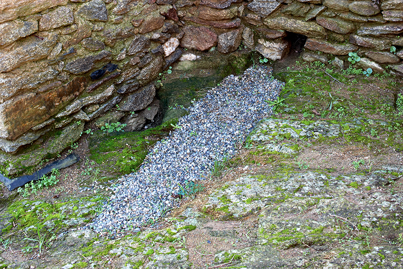
In the subsoil beneath the houses anthropomorphic tombs, excavated out of the rock, have been discovered. They are the remains of the graveyard from the 10th and 11th centuries which surrounded the church before the town was built because, although there was no population, Santa Creu was the burial ground for the people who lived scattered around the area.
Today, amidst the remains of the houses, we can see some of those tombs filled with gravel for protection.
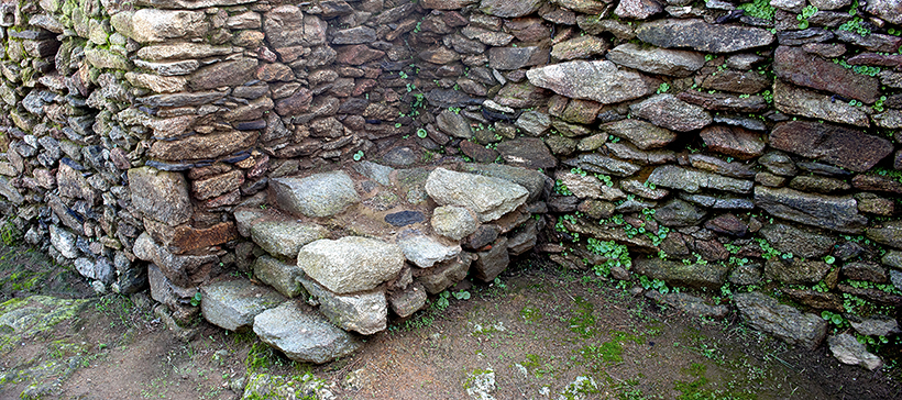
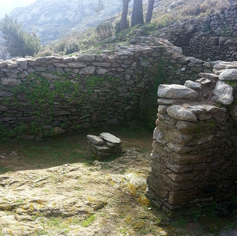
This space acted as a hall from which the different rooms of the house led off and connected the antechamber with the private spaces. From here a staircase led to the upper floor where the kitchen and other rooms were located. The remains of a central pillar suggests the existence of a ceiling with wooden rafters.
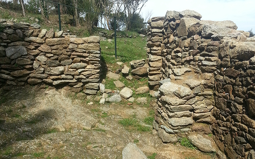
The house had a second entrance from the side alley, which joined the road that led to the castle. Today we can still take this route, more or less modified by a forestry track, as far as the castle, 1.5 kilometres away.
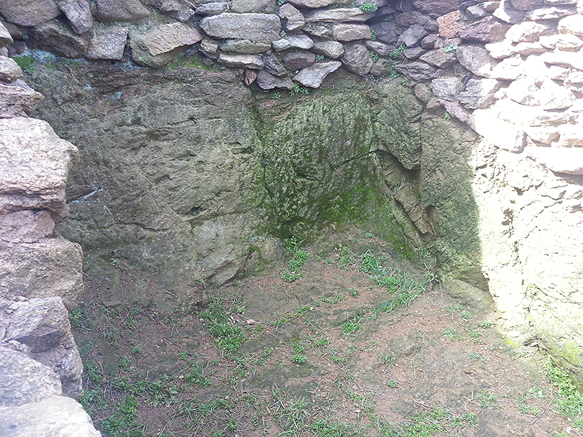
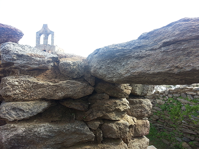
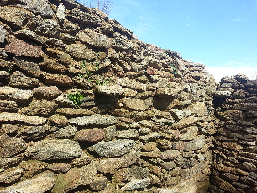
The uneven ground forced the builders of the house to do an enormous task of adaptation. In this room we can see how they carved the rock to use it as part of the wall and the flooring.
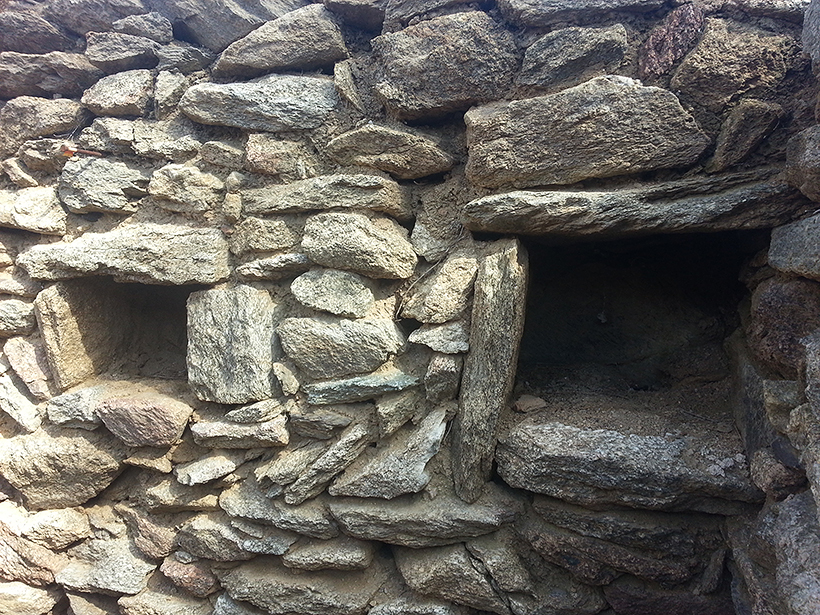
In the same room the lintel of the door and the brackets that held up the rafters of the ceiling have been conserved, as well as some small niches opened in the wall.
Because of the slope of the land, the kitchen was on a higher level and was reached by the stairs from the hall. The excavations have turned up a central fireplace, now hidden by niches or cupboards on the walls. A pot which still contained fish scales was found on the bench.
The remains of animals retrieved in the town indicate that the inhabitants ate the meat of lambs and goats which they raised themselves, as well as pigs and cattle, mostly bought outside. They also ate game, though less of it, and fish such as tuna and some kind of shark.
Located in front of the church, this square is the centre of the town, where public activity was concentrated and the main roads into the town met, as well as many of the streets and alleys. According to the records the stalls of the weekly market were set up here. They were patronised by many of the pilgrims visiting the monastery.

However, although the town was abandoned, the square continued to be the meeting point for the Festival of the Holy Cross which, until the 19th century, brought together the inhabitants of the towns of Cap de Creus.
It has an irregular shape, the surface is levelled and in the subsoil remains of the old graveyard with the anthropomorphic tombs have been found. This space overlaps with the sanctuary, a sanctified space that encircled the church with a radius between twenty and thirty paces in width, where no violent acts could be committed on pain of excommunication. It therefore provided a protective space.
The church is a singular element in the town, since it was built before it and continued to be a place of worship after its inhabitants had abandoned it. Linked to the monastery, it came into being to provide a service for the people who lived scattered around the area. The first dedication was to the Holy Cross, but in the early 16th century it was dedicated to St Helena.

Formally, the church is the product of successive alterations which make it a singular building in the Romanesque style. The original, from the 9th century, has a single nave and uses and old watchtower as an apse. In the 10th or 11th century the chevet took on its present form when a new apse and two side chapels were added to the tower.
The decline in population after the 15th century caused the building to fall into decline and lose its status as parish church, so that from 1563 it was administered by the rector of La Selva de Mar.
In an attempt to revive worship, in the 17th century the monastery undertook some extension work by building the side naves. It involved the construction of broad arcades made of local grey marble to connect the side naves with the central one, as well as changing the flooring and putting on a new stone roof. But despite those efforsts the bells were soon removed, the building started to crumble and was looked after by a chaplain until the end of the 19th century, when it was completely abandoned.
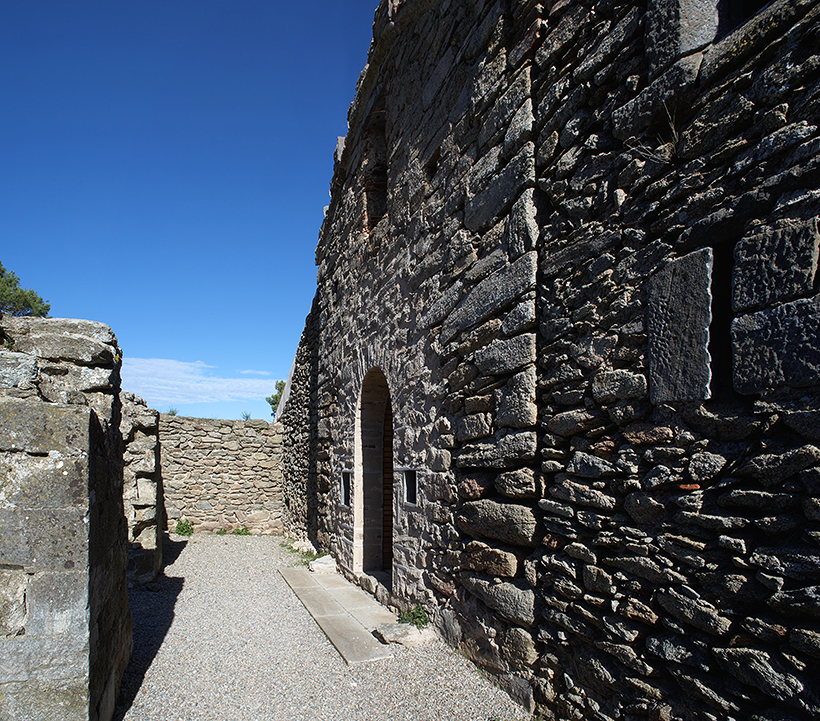

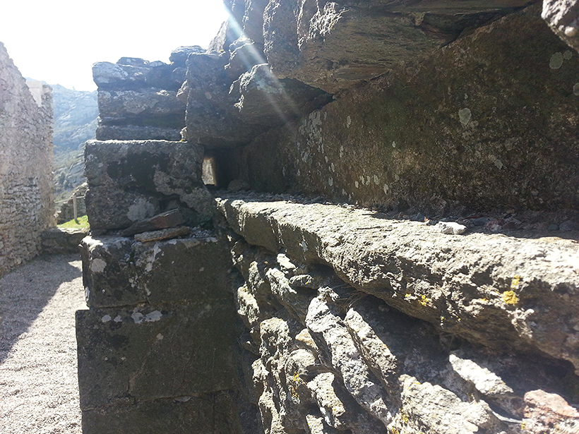
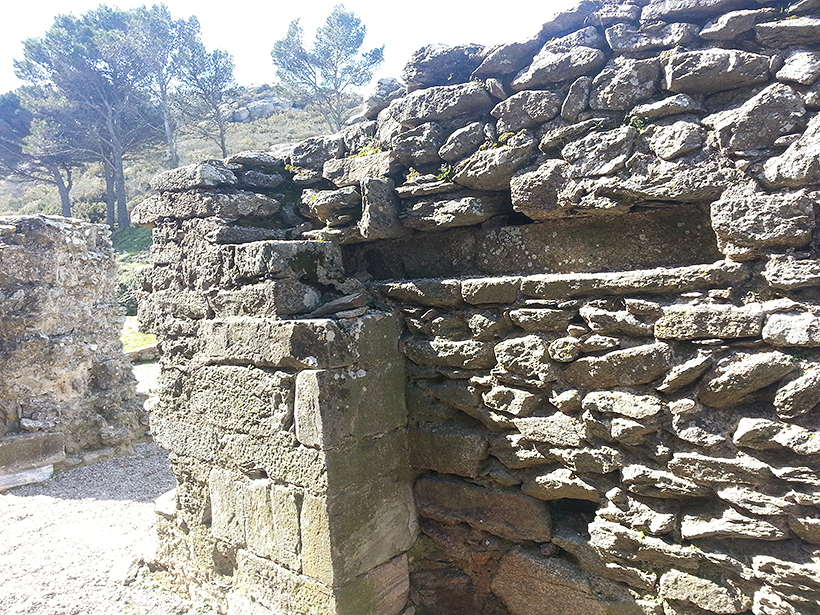
This porch is the final point of the 17th century extension of the church. It has a doorway made of blocks of light grey marble, of the same kind as the arccades of the side naves which were built at the same time. Of that doorway, however, only some signs remain at ground level.
From the interior we can see remains of the bolt that closed the gateway.
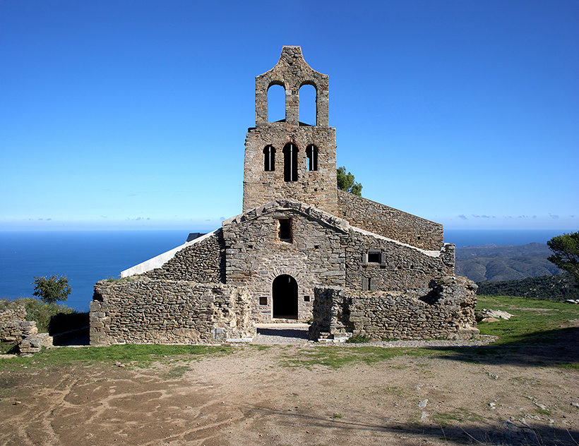
The main façade clearly shows the evolution from a single nave to the extension with the side naves, thanks to the differences in construction. In general, it has been greatly affected by the successive alterations. The present day door, for example, does not correspond to the initial shape, but to the enclosure that was made after the first gateway had been dismantled. These two stages can be seen from the use of different materials. The only original element remaining is the finish of the eaves of the roof, decorated with stones and serrated tiles laid vertically.
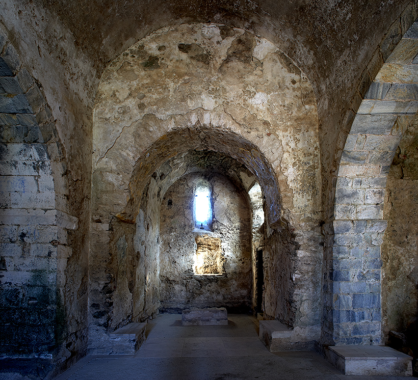
The apse is an annex dating from the 10th or 11th century which is attached to the old watchtower, around which the whole church was structured. The construction involved demolishing the base of the tower and building a horsehoe arch which acted as a triumphal arch. The light came in through a small window, decorated on the outside with fragments of brick with a serrated edge. The base of the altar has been conserved; in 1420 it had to be moved to open the door to the sacristy that was being built.
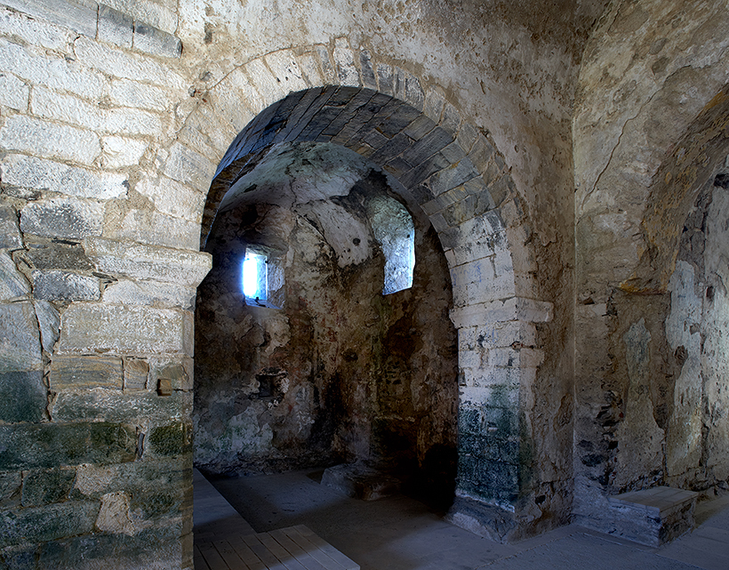
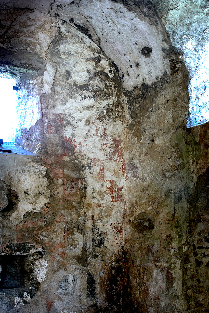
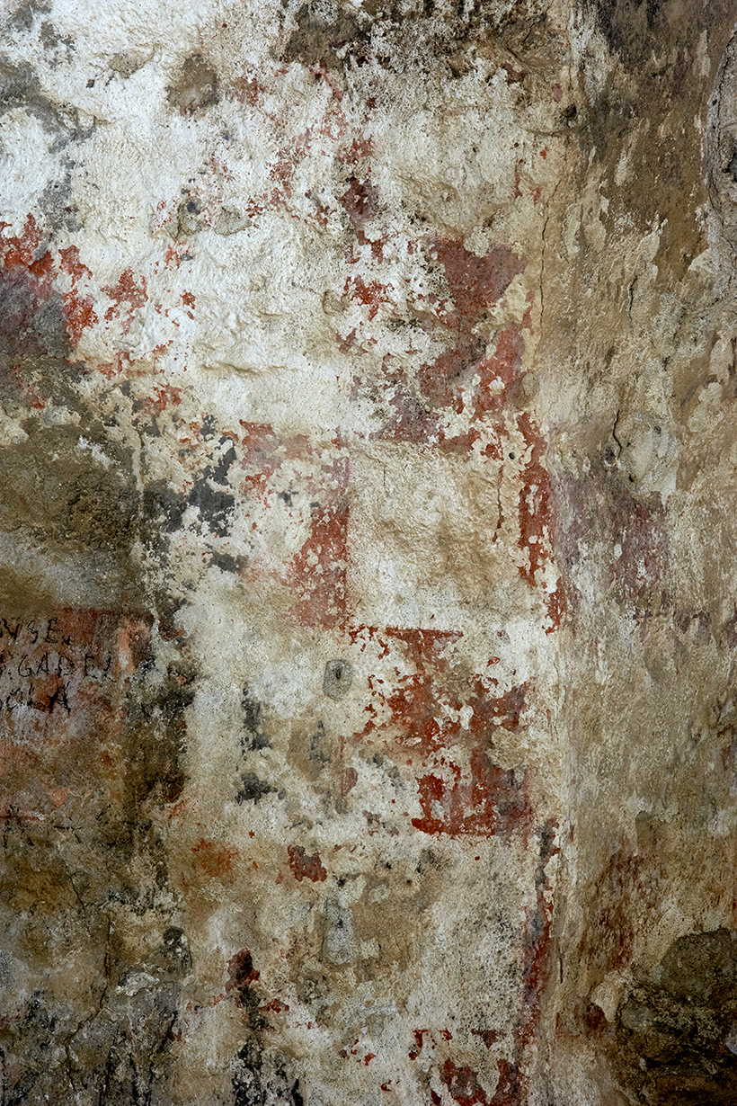
The church walls were originally roughcast with limestone mortar and decorated with paintings. In the north chapel a grid of alternating red and white squares has been conserved, though in a poor state. The rest of the decoration has been lost and all that remains are some signs of painting on the arch of the central apse.
The chapel has also conserved the stone base of the altar, attached to the wall, and the grooves of the iron grille, which was probably installed in the 17th century.
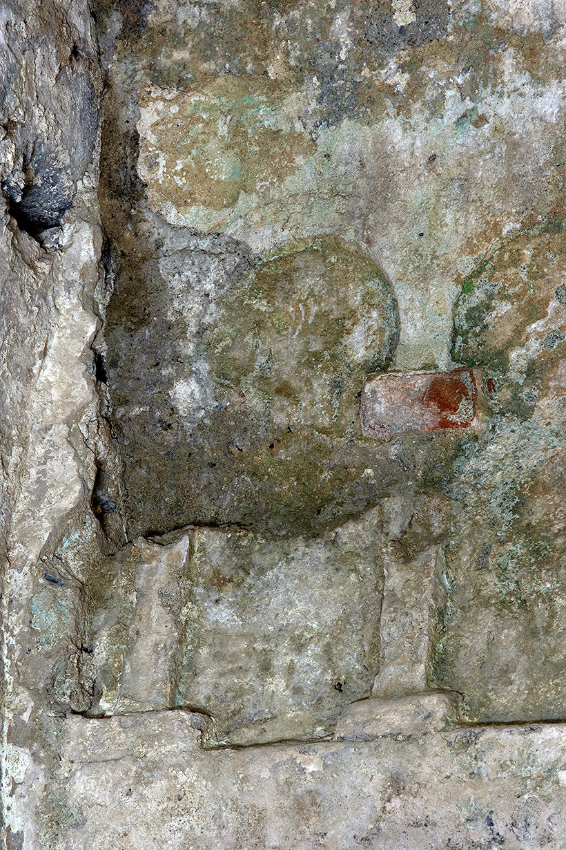
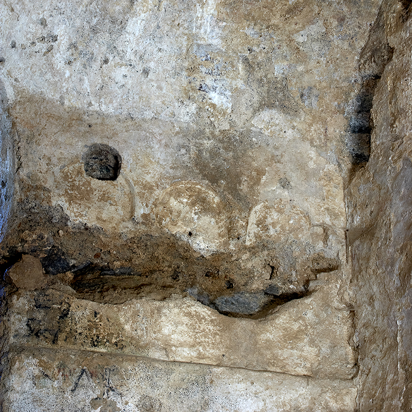
The outstanding element of the south chapel is the remains of reliefs made with mortar which depict arches on bases, with their capitals. In general, it cannot have been very different from the other chapel and was also closed off by a grille.
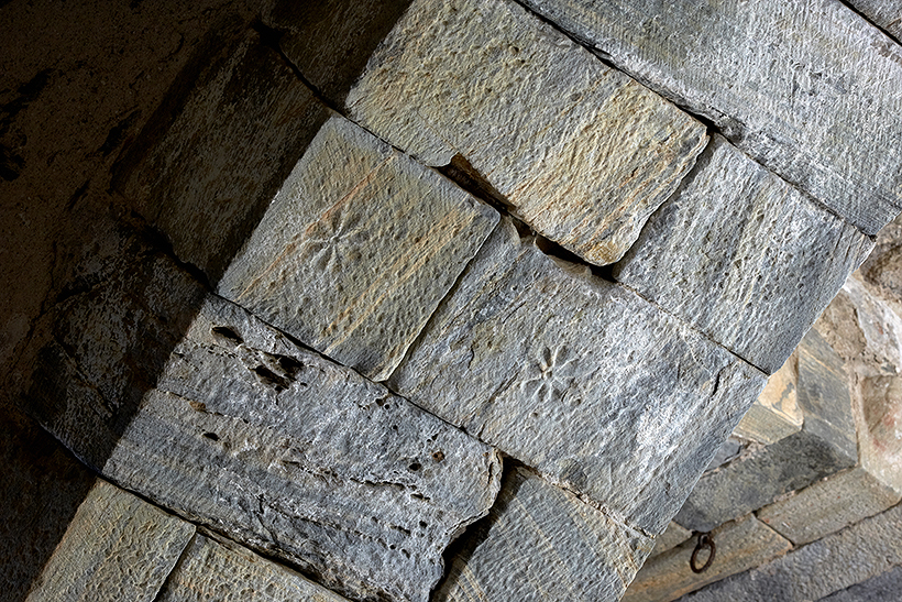
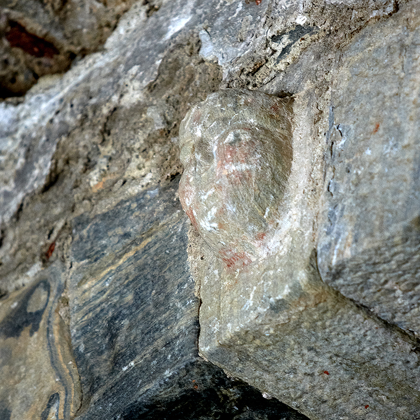
On the marble voussoirs of the arches are small decorated reliefs with no specific arrangement, such as a face above the central arch, or clovers, a pine cone, spherical fruit and flowers on the arches that connect with the side naves.
We know that there were other ornamental elements, such as Gothic altars made of Genoa marble, which had still been conserved at the end of the 19th century.
After the town was abandoned and the status of parish church lost, the church remained in the custody of a chaplain. According to a pastoral visit from the early 17th century, he had no house of his own and slept in the church. The fact that the bishop looked askance at that led to the building of this house, also called the new sacristy, in the first half of the 18th century.

It is a simple dwelling with ground floor and upper floor which can be entered from the interior of the church or through the sacristy. On the first floor a door leads to the interior of the bell tower above the vaulted roof. The roof, which has not been conserved, had one side sloping to the south.
In 1420 a new construction was attached to the chevet of the church to be used as a sacristy. It has a ground floor, a stone vaulted roof and another storey of which onlyy parts of the walls remain. The door still has an engraved cross on the lintel.
From here the parish was administered. The revenue belonged to Sant Pere de Rodes, since the church was a possession of the monastery. The abbot also had the power to choose the priests. In the 14th and 15th centuries the church was governed by three hebdomadaries, as well as a sacristan and some lay brothers. They were obliged to live in the town; some of them even had more than one house there. In the mid 16th century, however, it passed into the hands of the rector of Sant Esteve de la Mata, in Selva de Mar, because of the fall in population. Despite that, until the 18th century the sacristy continued to be used as a restricted funeral area.
As opposed to how it might seem today, the zone in which the town is set was, in the Middle Ages, busy and inhabited. Sant Pere Monastery acted as an economic draw of the first order. The inhabitants of the area who provided services for the monastery and took care of the pilgrims profited. Moreover, they were engaged in wxploiting the available natural resources, basically the harvest of cereals, vines, olives and meadows.

Thanks to the traffic generated by the monastery, the town was well connected with the other main ones of the surroundings such as La Selva, La Vall, Llançà, Castelló d'Empúries or Roses, as well as villages, hamlets and scattered farmhouses, also within the domain of the monastery.
The town also profited from the nearby seaports. Within the visual field of Santa Creu we should mention Port de La Vall and what today is Port de la Selva, called Port Llen at the time. Here there were small buildings, called shops, basically engaged in the exploitation of the sea, but also in small trade along the coast, supported by ports with a greater capacity and movement, such as Roses and Llançà, to mention the closest ones.
Around the church, from over the centuries we find the remains of various graveyards. The oldest is the one with the tombs excavated out of the rock, anthropomorphic in form with stone lids, which can be dated between the 10th and 11th centuries. Given that their existence precedes the building of the town, remains have been found over a broad area that overlaps with the surface area of the sanctuary, even under the houses, whose building damaged them seriously.

In the 12th century, when the place was already inhabited, the graveyard was laid out and concentrated next to the chevet and the south of the church. These tombs were simpler, at first a box of stone slabs and then graves opened in the ground and coffins. Later it occupied the northern strip with tombs that were also very simple.
The fall in population and the loss of the status of parish church marked the end of the burials at Santa Creu, despite later attempts to revive worship by forcing the inhabitants of La Selva and La Vall to hear mass and be buried in the old graveyard.
This is the oldest element of the church. Indeed it was there before it, since it was a watchtower for the surrounding territory, commanding a sweeping view of the coast. It has a square ground plan and the shape of a truncated pyramid, broader at the base. Originally it was roughcast with limestone mortar and there are signs that it was crowned with merlons.
When the church was built in the 10th century, the nave was attached to the tower, which was used to contain the altar. Later on a new chevet was built with two side chapels and a new apse adjoining the sides of the tower. That was when the openings in the first floor were made and decorative elements added.
Later a bell gable was built to hang two bells, which have since disappeared. One was taken to the Sant Fruitós de la Vall church in the 17th century and later to Sant Esteve de la Selva. Despite the demands of the bishops, it never returned. The other was stolen by bandits in the early 19th century. Above the vault of the central nave we can still see the holes the ropes fro ringing them were passed through.
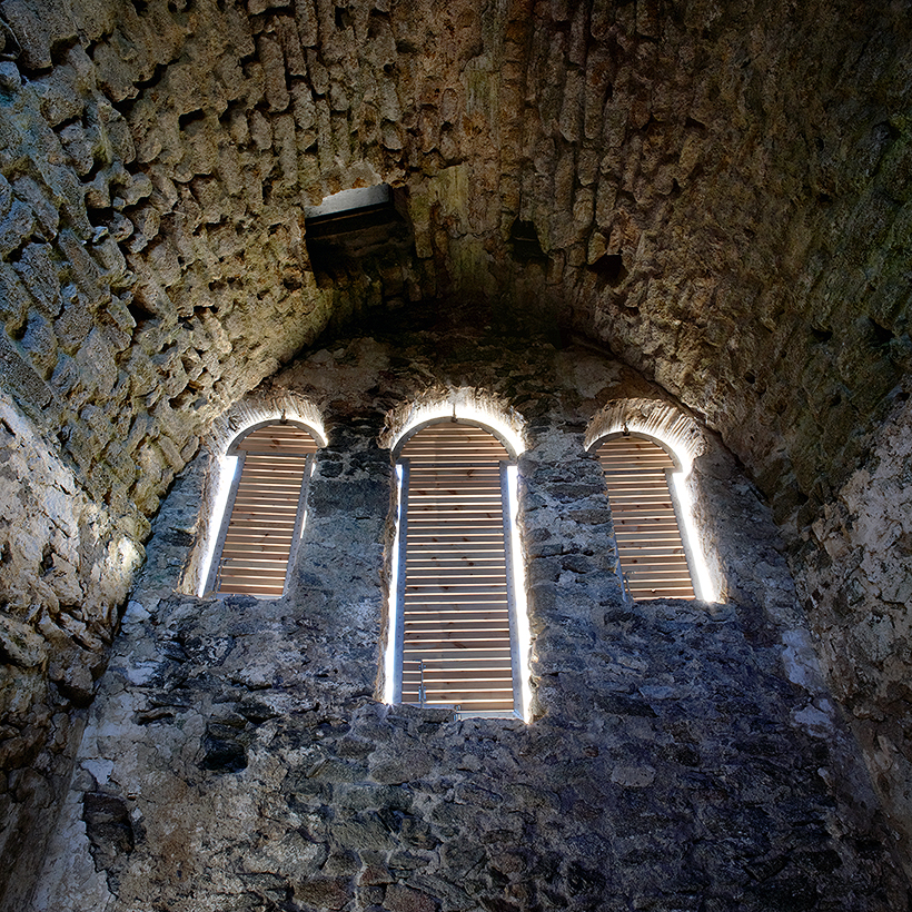

With the alterations to the church openings were made in the tower: three large horseshoe arch windows framed with bricks laid edgeways, and two smaller matching ones onethe other sides. To the north and south there were niches decorated with a grid of pieces of ceramic and small stones.
To the north of the church we can see the ruins of a district that stretched well beyond the original core. The first line of houses, with façades on the square, would not have been very different from the other dwellings around the church. However, we know nothing about the other buildings, what they were like or what uses they may have been put to, since there is no archaeologicla study.

The tower of the upper gateway, with the lower gateway, bears witness to the old enclosure of the town. With a quadrangular ground plan it has solid walls one metre thick and has conserved some loopholes. It is of the open-backed type, that is, a tower open to the interior of the precinct. Thanks to the height which has been conserved, it has been established that it had two floors separated by a stone vault.

The gateway lost its function when the growth of the population in the 13th and 14th centuries led to the expansion of the town. The new houses adjoined the gateway and stretched beyond it, so that it was cancelled out as a defensive element and reduced to a mere entrance.
The marks we can see on the rock reveal the continuous coming and going of people and even vehicles: there are ruts made by cart wheels. The position of hte houses that were built against the tower, however, must have made it difficult, if not impossible, to manoeuvre.
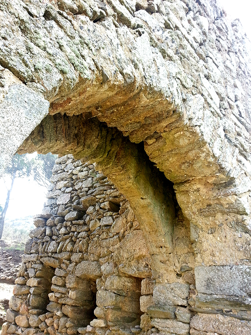
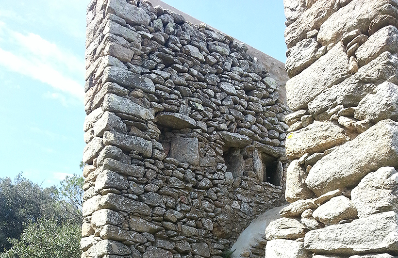
The entrance was through a basket arch which was closed by a portcullis. Inside the arch we can still see the space where it was housed. The system could raise or lower a gate by means of a winch and a counterweight.
The original defensive function of the tower is quite clear from the loopholes that have been conserved on each side. The narroq elongated shapes of these openings enabled the defenders to shoot from inside the tower without their fire being returned by the enemy.
The first work to recover this archaeological complex was done in 1972, alongside the opening of the road to the monastery. The gateways were restored and the ground around the church lowered, incovering some of the town walls. At the same time the church was cleaned and reinforced.

In the nineties the church was excavated and a restoration was undertaken to clean the roofs and walls, lay new flooring and retrieve the old openings of the church and the bell tower.
In 2006 annual excavation campaigns began thanks to an agreement between the University of Barcelona and the Museu d'História de Catalunya, in association with the Catalan Government Department of Culture Archives, Libraries, Museums and Heritage Section and Port de la Selva Council. Those works served not only to adapt the site for visits but also to acquire a deeper knowledge of the Mediaeval town.
From the upper gateway runs a road, mostly overlapping with the original which connected Santa Creu with other towns on either side of the mountain. We know that there were junctions with the main highways that led to Vilajuïga, Pau and Palau, and from there to Castelló d'Empúries and Roses, and over to Llançà. Stretches of those roads are still conserved, mostly protected by high stone walls at the sides.

Near the entrance to the town, on the right side of the road, we know that there was a spring, now overgrown with vegetation.
The town of Santa Creu, with its church, is part of the Serra de Rodes monumental complex, with Sant Pere Monastery and Sant Salvador Castle. The three elements are closely linked.
The church, which is older than the town, was a possession of the monastery, often disputed by the Counts of Empúries. Before houses began to sprincg up around it, the church already housed the graveyard for the people who lived in the surroundings.
In the early 12th century it became a parish church and the focal point of a town that soon spread under the dependence of the monastery. The inhabitants benefited from its proximity, since it provided them with a certain level of wealth and an economic activity that was largely devoted to its service. When the town reached its moment of splendour between the 13th and 14th centuries, it is calculated that about two hundred and fifty people lived there and, from the materials that have come to light in the excavations, it seems that some had a certain purchasing power.
The town began to go into decline from the second half of the 14th century. The reasons put forward for the fall in popularion include attacks by pirates, the effects of the plague epidemics and the decline of the monastic community itself. The uprising of the serfs against their feudal lords and the Catalan Civil War in the second half of the 15th century dealt the final blow to the town and it was totally abandoned. The church, on the other hand, remained active as a chapel until the end of the 19th century.
Sant Salvador Castle stands on the very summit of Verdera Mountain at an altitude of around 670 m. From the top of the mountain, you can see the Shrine of Sant Onofre at the foot of the cliff on which the castle perches. Beyond to the west, is L'Empordà, which stretches out northwards as far as the Pyrenees, where you can make out the profile of Canigó. The Fulf of Roses and teh Medes Islands are also clearly visible, as is El Montgrí massif, Les Guilleries and El Montseny. To the east, you can see the Monastery of Sant Pere de Rodes and the coast of Cap de Creus, which links to the north with the Gulf of Lion. This commanding position and outstanding view made the castle strategically very important. In addition, the steep and almost inaccessible terrain provided a system of defence that made the castle impregnable.
The castle is mentioned in numerous documents due to the constant disputes between the Monastery of Sant Pere de Rodes and the counts of Empúries, wo vied with each other to control it. The first reference dates from 904, suggesting that the castle was already in existence in the 9th century. Nevertheless, many of the surviving structures date from the 13th century, the time when Count Ponç IV of Empúries ordered that a new fort be built given the poor state of repair of the existing cstle.
With the passing of the years, the strategic importance of castles perched on rocks -the invincibility of which was due to the difficult terrain on which they were sited- declined as a result of developments in weaponry and warfare techniques. Even so, Sant Salvador Castle was still in use in the 16 th century as a look-out post to combat piracy.
The Benedictine monastery of Sant Pere de Rodes is the centre of the monumental complex on the Verdera sierra. The oldest records, dating from the 9th century, make mention of a monastic cell, dependent on the monastery of Sant Esteve de Banyoles, although there are archeological remains that bear witness to an earlier occupation.
The foundation of the independent monastery in the 10th century ushered in a period of splendour promoted by the nobility of the Empordà. Now the centre of feudal and economic power, the community launched a building project that would reflect its strenght. The works went on into the 10th and 11th centuries and essentially included the enclosed area made up of the church, the cloisters and the premises around them.
One of the peculiar features of Sant Pere de Rodes is the existence of two cloisters which were never in use at the same time. The restoration has recovered the original one, which was buried in order to build the 12th century one on top of it. In thsi way we have been able to conserve a building model which has been lost in most cases owing to later refurbishments.
From the 15th century the surrounding countryside was ravaged by constant looting, pirate raids and wars which more than once forced the monks to abandon the monastery.
The economic revival of the 18th century provided the means to undertake new projects, such as the refurbishment of the precinct around the cloister, consisting of service buildings, mostly erected in the 17th and 18th centuries. Some of the planned works were never carried out because in 1798 the community abandoned the monastery definitively. From that time the complex went into a swift decline.

accessibility | legal notice and privacy policy | cookies | © Departament de Cultura 2018 Agència Catalana del Patrimoni Cultural


